Today in Kerbiquet, high humidity will give rise to unsettled weather in the early part of the day.
Temperatures will vary between 7 and 10°C with values close to normal.
The reliability of the situation is good.
This morning
7°Feels Like 4°due to the wind
Gusts 25 km/hNE 15 km/h
Very cloudy to overcast sky.
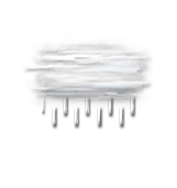
Drizzle clearing gradually.
No risk of rain
This afternoon
10°Feels Like 9°
Gusts 15 km/hN 10 km/h
Very cloudy sky turning overcast.
Drizzle starting to fall at the end of the afternoon.
Risk of rain
65 %
UV index0Low
This evening
9°Feels Like 8°
Gusts 20 km/hNW 15 km/h
Overcast sky.
Persistent drizzle.
Risk of rain
65 %
Night
8°Feels Like 6°
Gusts 20 km/hSW 10 km/h
Very cloudy sky with short clear periods.
Risk of a few drops of rain.
Risk of rain
25 %
Share
CLIMATE info
Rain
+20%
normal
More rain than normal
Water restriction: No restrictions
Temperature
0°C
normal
Warmer than normal
Normal temperature : 8°C
Average, today :
8°C
One year ago : 5°C