Home
Radar
Log in
Home
United States
Radar
Mountain
World
My account
Log in
Contact us
Search results
See all results
CAN'T FIND YOUR LOCATION?
Request the creation of a location
My location
Recent searches
Clear my history
Favorites
Edit my favorites
Create your account to save your favorites.
Log in
Weather
New-Zealand
Whakapapa (ski resort)
WEATHER WHAKAPAPA
Iwikau - New-Zealand
Fri
24
-
-
Sat
25
-
-
Sun
26
-
-
Mon
27
-
-
Tue
28
-
-
Wed
29
-
-
Thu
30
-
-
Fri
31
-
-
Sat
01
-
-
Sun
02
-
-
Mon
03
-
-
Tue
04
-
-
Wed
05
-
-
Thu
06
-
-
Fri
07
-
-
365
days
Day
Time / Hour
Compare
Today's Forecast
Forecast produced by
Alexis VANDEVOORDE
Updated at
12h15
- Next update at
18h15
(local time)
In Short
Weather radar
Hour by hour
Weather comparator
Expert’s summary
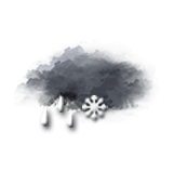
This afternoon in Whakapapa, warning: winds gusting very strongly.
Temperatures will vary between 4 and 5°C, it will be cold.
The reliability of the situation is good.
This afternoon
4°
Feels Like 1°
due to the wind
20 km/h
Gusts
65 km/h
Overcast and misty. Limited visibility.
Drizzle becoming heavier and forming rain.
Risk of rain
90 %
UV index
0
Low
Freezing level 0°
1900 m
Snow-rain limit
1550 m
Snow expected
0 cm
This evening
5°
Feels Like 2°
due to the wind
20 km/h
Gusts
65 km/h
Overcast and misty. Limited visibility.
Sleet showers.
Risk of rain
90 %
Freezing level 0°
1800 m
Snow-rain limit
1500 m
Snow expected
0 cm
Night
4°
Feels Like 1°
due to the wind
15 km/h
Gusts
50 km/h
Overcast and misty. Limited visibility.
Sleet showers.
Risk of snow
85 %
Freezing level 0°
1550 m
Snow-rain limit
1250 m
Snow expected
0 cm
Tomorrow's weather
Weekend weather
Receive the weather forecast for my ski resort
Add Weather Crave to your favorite sources
Share
Link copied
Ephemeris
Friday 24 july
Day
+2 min
Waxing
gibbous Moon
Sunrise
07h26
Sunset
17h21
Christina the Astonishing
Next few days
Tomorrow,
Saturday 25
-
|
-
-
-
km/h
Sunday 26
-
|
-
-
-
km/h
Monday 27
-
|
-
-
-
km/h
Ski resort
arround Iwikau
Ski resort
Whakapapa
Near
Whakapapa
Iwikau
Whakapapa
Tongariro National Park
Waikune
Horopito
Turoa (ski resort)
Waiōuru
Turoa Village
Ohakune
National Park
Raurimu
Raetihi
Weather France
Lyon
Marseille
Nice
Paris
Toulouse
Angoulême
Annecy
Arcachon
Arras
Auch
Aurillac
Auxerre