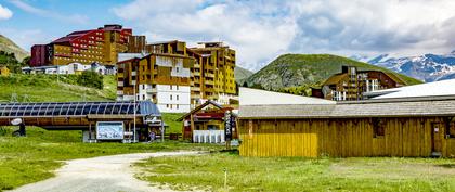
weather Norway Bjorli Skisenter AS
  • 15 day forecast

    - -
Day

Hourly weather

Cyril BONNEFOY

Forecast produced by Cyril BONNEFOY

Updated at - Next update at (local time)

Light snowfall starts tomorrow at 10 a.m.

Wednesday 11


  • 12h
  • 13h
  • 14h
  • 15h
  • 16h
  • 17h
  • 18h
  • 19h
  • 20h
  • 21h
  • 22h
  • 23h
  • 00h
  • 01h
  • 02h
  • 03h
  • 04h
  • 05h
  • 06h
  • 07h
  • 08h
  • 09h
  • 10h
  • 11h
Time Temperature Rain Wind
  • Low Moderate
  • Slightly cloudy No precipitation Calm Gusts 5
  • Slightly cloudy No precipitation Calm Gusts 5
  • Slightly cloudy No precipitation Calm Gusts 5
  • Slightly cloudy No precipitation Calm Gusts 5
  • Very cloudy No precipitation Calm Gusts 5
  • Slightly cloudy No precipitation Calm Gusts 5
  • Slightly cloudy No precipitation Calm Gusts 5
  • Sunny periods No precipitation Calm Gusts 5
  • Alternating sunshine and cloud No precipitation Calm Gusts 5
  • Slightly cloudy No precipitation Calm Gusts 5
  • Slightly cloudy No precipitation Calm Gusts 5
  • Sunny No precipitation Calm Gusts 10
  • Sunny No precipitation Calm Gusts 10
  • Slightly cloudy No precipitation Calm Gusts 10
  • Alternating sunshine and cloud No precipitation Calm Gusts 10
  • Very cloudy No precipitation Calm Gusts 10
  • Very cloudy No precipitation Calm Gusts 10
  • Very cloudy No precipitation Calm Gusts 10
  • Very cloudy No precipitation Calm Gusts 5
  • Overcast Risk 30% Chance of snow Calm Gusts 10
  • Very cloudy Risk 40% Chance of snow Calm Gusts 10
  • Very cloudy Risk 40% Chance of snow Calm Gusts 5
  • Light snow falls Risk 90% Light snowfall Calm Gusts 5
  • Light snow falls Risk 80% Light snowfall Calm Gusts 10
  • 50% 30% 10% 1900 20% 1000 lm uv 4 Moderate 44% Comfortable 1027 hPa Excellent > 20km Excellent
  • 50% 30% 10% 1900 20% 1000 lm uv 4 Moderate 44% Comfortable 1027 hPa Excellent > 20km Excellent
  • 50% 30% 10% 1900 20% 1000 lm uv 4 Moderate 44% Comfortable 1027 hPa Excellent > 20km Excellent
  • 50% 30% 10% 1900 20% 1000 lm uv 4 Moderate 44% Comfortable 1027 hPa Excellent > 20km Excellent
  • 50% 30% 10% 1900 20% 1000 lm uv 4 Moderate 44% Comfortable 1027 hPa Excellent > 20km Excellent
  • 50% 30% 10% 1900 20% 1000 lm uv 4 Moderate 44% Comfortable 1027 hPa Excellent > 20km Excellent
  • 50% 30% 10% 1900 20% 1000 lm uv 4 Moderate 44% Comfortable 1027 hPa Excellent > 20km Excellent
  • 50% 30% 10% 1900 20% 1000 lm uv 4 Moderate 44% Comfortable 1027 hPa Excellent > 20km Excellent
  • 50% 30% 10% 1900 20% 1000 lm uv 4 Moderate 44% Comfortable 1027 hPa Excellent > 20km Excellent
  • 50% 30% 10% 1900 20% 1000 lm uv 4 Moderate 44% Comfortable 1027 hPa Excellent > 20km Excellent
  • 50% 30% 10% 1900 20% 1000 lm uv 4 Moderate 44% Comfortable 1027 hPa Excellent > 20km Excellent
  • 50% 30% 10% 1900 20% 1000 lm uv 4 Moderate 44% Comfortable 1027 hPa Excellent > 20km Excellent
  • 50% 30% 10% 1900 20% 1000 lm uv 4 Moderate 44% Comfortable 1027 hPa Excellent > 20km Excellent
  • 50% 30% 10% 1900 20% 1000 lm uv 4 Moderate 44% Comfortable 1027 hPa Excellent > 20km Excellent
  • 50% 30% 10% 1900 20% 1000 lm uv 4 Moderate 44% Comfortable 1027 hPa Excellent > 20km Excellent
  • 50% 30% 10% 1900 20% 1000 lm uv 4 Moderate 44% Comfortable 1027 hPa Excellent > 20km Excellent
  • 50% 30% 10% 1900 20% 1000 lm uv 4 Moderate 44% Comfortable 1027 hPa Excellent > 20km Excellent
  • 50% 30% 10% 1900 20% 1000 lm uv 4 Moderate 44% Comfortable 1027 hPa Excellent > 20km Excellent
  • 50% 30% 10% 1900 20% 1000 lm uv 4 Moderate 44% Comfortable 1027 hPa Excellent > 20km Excellent
  • 50% 30% 10% 1900 20% 1000 lm uv 4 Moderate 44% Comfortable 1027 hPa Excellent > 20km Excellent
  • 50% 30% 10% 1900 20% 1000 lm uv 4 Moderate 44% Comfortable 1027 hPa Excellent > 20km Excellent
  • 50% 30% 10% 1900 20% 1000 lm uv 4 Moderate 44% Comfortable 1027 hPa Excellent > 20km Excellent
  • 50% 30% 10% 1900 20% 1000 lm uv 4 Moderate 44% Comfortable 1027 hPa Excellent > 20km Excellent
  • 50% 30% 10% 1900 20% 1000 lm uv 4 Moderate 44% Comfortable 1027 hPa Excellent > 20km Excellent
These parameters are reserved for subscribers.
You have 50% to discover:

Precipitation amount, cloud cover, light index, UV index, air humidity, air pressure and visibility.
logo VIP
  • Faster browsing
  • Detailed weather forecast
  • No ads
  • Access to Live TV

Station Info

open
Bjorli Skisenter AS
avalanche risk 1 Avalanche Risk
0/5 -Very High

Snow


50 cm at the top (1250m)
30 cm down (575m)

Snowfall


12 days ago : 3 cm
8 months ago : 2 cm

Track Info


Lifts 1/6
Snow Parks -/1
Nordic ski N.C.
Back skiing N.C.

Open tracks


2 4
1 1
1 3
- 2
with ski info

Ephemeris


Wednesday 11 december

  • Day
    -2 min
  • Waxing
    gibbous
  • Sunrise
    09h44
  • Sunset
    14h57
  • Damasus

Next few days


Points of interest arround Bjorli


Near Bjorli Skisenter AS