Today in Quechapata, the weather will become more uncertain during the day.
Temperatures will vary between -1 and 11°C, it will be cold in the morning.
The reliability of the situation is very good.
3:00 to 6:00
-1°Feels Like -2°
CalmGusts15 km/h
Clear sky.
No precipitation.
No risk of rain
This morning
-1°Feels Like -3°
15 km/hGusts15 km/h
Sunny.
No precipitation.
No risk of rain
UV index11Extreme
This afternoon
11°Feels Like 13°due to the sun
15 km/hGusts20 km/h
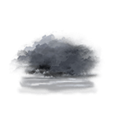
Gradually turning overcast and changing to thundery weather.